What a Plant Hardiness Zone Map Actually Measures
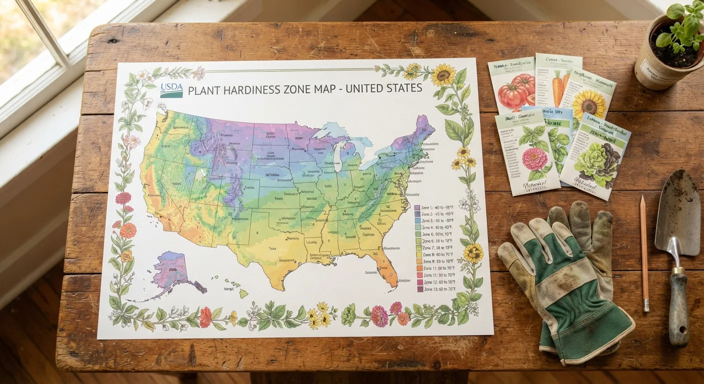
The USDA Plant Hardiness Zone Map divides the contiguous United States - plus Alaska, Hawaii, and Puerto Rico - into 13 numbered zones (1 through 13), each representing a 10°F range of average annual minimum winter temperatures. Zone 1 covers the coldest regions (think interior Alaska), while Zone 13 covers the warmest (parts of Hawaii and southern Florida).
Each zone is further split into two half-zones, labeled a (colder) and b (warmer), creating a 5°F subdivision. So Zone 7a averages minimum lows of 0°F to 5°F, while Zone 7b averages 5°F to 10°F.
One important caveat: hardiness zones measure cold tolerance only. They tell you the lowest temperature a plant is likely to survive - not how well it handles summer heat, humidity, drought, or soil conditions. Hardiness is a floor, not a complete growing profile. For a fuller picture, pair zone information with light and shade guidance for your space.
| Total Zones | 13 (Zones 1-13) (USDA Agricultural Research Service) |
| Temperature Range per Zone | 10°F span (USDA Plant Hardiness Zone Map) |
| Half-Zone Subdivision | 5°F (labeled 'a' and 'b') (USDA Agricultural Research Service) |
| What Zones Measure | Average annual minimum winter temperature (USDA Plant Hardiness Zone Map) |
| What Zones Do NOT Measure | Heat, humidity, rainfall, or soil type |
| Lookup Tool | planthardiness.ars.usda.gov (ZIP code search) (USDA Agricultural Research Service) |
How to Find Your Zone and Use It
Finding your zone takes less than a minute. The USDA Agricultural Research Service hosts an interactive online map at planthardiness.ars.usda.gov - enter your ZIP code and it returns your exact zone designation. Most plant nursery tags, seed catalogs, and plant database listings include a "Hardiness Zones" range (e.g., Zones 5-9), meaning the plant survives winters across that span.
Hardiness Zone
A geographic area defined by the USDA based on the average lowest winter temperature. Plants labeled for a specific zone are expected to survive winters in that range without significant protection.
Minimum Winter Temperature
The coldest temperature a location typically experiences in an average winter year. This is the core data point used to assign hardiness zones.
Microclimate
A localized climate condition that differs from the surrounding area - such as the warmth near a brick wall or the frost-prone air at the bottom of a slope - which can shift your effective growing conditions slightly warmer or cooler than your listed zone.
Half-Zone (a/b)
Each USDA hardiness zone is split into two 5°F subdivisions: 'a' is the colder half and 'b' is the warmer half. For example, Zone 6a is colder than Zone 6b.
Reading the Zone Range on a Plant Label
- Find your zone. Look up your ZIP code on the USDA map.
- Check the plant's listed range. If your zone falls within it, the plant is considered winter-hardy in your area.
- Consider your microclimate. A south-facing wall, raised bed, or urban heat island can push your effective growing conditions warmer by half a zone or more. Low-lying frost pockets can do the opposite.
If you're gardening without a yard, zone data still matters - potted plants in containers have less insulating soil mass and may need more cold protection than in-ground equivalents. See container gardening tips for renters for practical strategies. When selecting plants that will return year after year, understanding perennials vs. annuals helps you match your investment to what your zone can realistically support.
At the end of the growing season, use your zone knowledge to time protective measures correctly. A end-of-season garden checklist walks you through soil prep and plant protection before cold sets in.
Zones Are a Starting Point, Not the Full Story
A plant rated for your zone can still struggle if your soil drains poorly, your summers are unusually humid, or your site gets too little sun. Treat your zone designation as one key filter among several when evaluating whether a plant is right for your space. Local cooperative extension offices - typically run through state universities - are a free, reliable resource for region-specific planting guidance.