The Physical Landscape: Volcanoes, Glaciers, and Everything Between
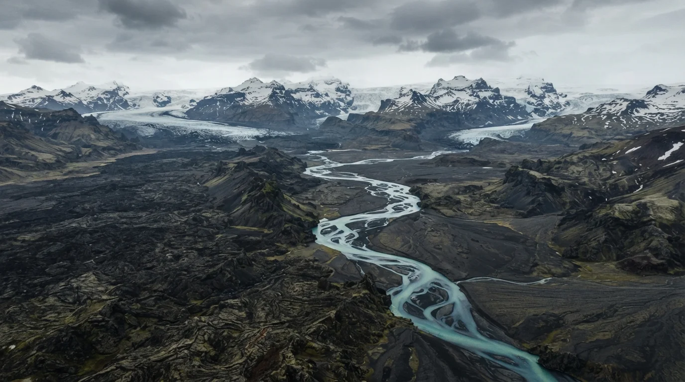
Iceland's terrain is a direct product of its location on the Mid-Atlantic Ridge. Volcanic eruptions have been building the island for roughly 16–18 million years, and that process hasn't stopped. Active volcanic systems — including Hekla, Grímsvötn, and the Reykjanes Peninsula — mean travelers should monitor eruption activity through the Icelandic Meteorological Office before and during any trip.
The south and west coasts are the most accessible and most visited. Reykjavík, the capital, sits on the southwestern tip. The famous Golden Circle route — Þingvellir National Park, the Geysir geothermal area, and Gullfoss waterfall — loops through relatively flat terrain east of the capital.
The north offers drier conditions and a different character: whale-watching in Húsavík, the dramatic Mývatn lake district, and the coastal town of Akureyri. The Westfjords — Iceland's most remote peninsula — involve long, winding roads with limited services, demanding a more deliberate travel plan.
11%
Of Iceland covered by glaciers
According to the National Land Survey of Iceland, glaciers cover approximately 11% of the country's total surface area.
828 miles
Length of Iceland's Ring Road
Route 1 encircles the entire island and is the primary road infrastructure connecting major regions.
~30+
Active volcanic systems in Iceland
Iceland has more active volcanoes than any other European country, according to the Icelandic Meteorological Office.
The interior highlands are essentially a different country. Entirely uninhabited and accessible only in summer via F-roads, they include vast lava deserts, hot spring valleys like Landmannalaugar, and glacier approaches. These areas are not for unprepared visitors.
Weather Patterns and What They Actually Mean on the Ground
The Icelandic saying — "if you don't like the weather, wait five minutes" — is repeated for good reason. Iceland sits at the intersection of polar and sub-polar air masses, making rapid weather shifts the norm rather than the exception. Conditions that look benign in the morning can become hazardous by afternoon.
Check Official Sources Daily While Traveling
The two most useful resources for real-time conditions in Iceland are vedur.is (Icelandic Meteorological Office) for weather forecasts and safetravel.is for road closures, travel alerts, and hiking conditions. Both are available in English. Checking them each morning before driving is the single most practical habit any Iceland visitor can develop.
Regionally, the south and west receive significantly more precipitation than the north. Reykjavík averages around 31 inches of rain per year; Akureyri, sheltered by mountains, is considerably drier. The south coast — including the areas near Vík and Jökulsárlón glacier lagoon — is frequently overcast and rainy, which matters if you're planning photography-focused itineraries.
Wind is a consistent factor throughout Iceland, particularly on exposed coastal roads. Strong gusts can make door-opening dangerous and have caused vehicle damage when travelers misjudge conditions. The Icelandic Road and Coastal Administration (vegagerdin.is) posts real-time road status including wind warnings — checking it daily is a practical habit, not optional caution.
Snow can fall in any month at higher elevations, and ice can persist on mountain roads well into May. This isn't dramatic — it's just the operational reality of driving in Iceland outside the core summer window.
What This Means for Planning Your Trip
Geography and climate don't just set the scenery — they set the constraints. A few structural considerations are worth internalizing before booking anything.
Daylight
In June and July, Iceland experiences near-continuous daylight. This is genuinely disorienting for first-time visitors and can compress or expand what's possible in a single day. Conversely, mid-December brings roughly 4–5 hours of usable daylight, requiring tighter daily planning. Neither is inherently better; both require awareness.
The Ring Road Is Not the Whole Country
Route 1, the Ring Road, circles the entire island and covers about 828 miles. It's well-maintained and paved, but it bypasses the Westfjords entirely and skirts the highlands. Travelers who complete the Ring Road and assume they've seen Iceland have missed a significant portion of the country's most dramatic geography.
Build In Flexibility
Weather-related closures, volcanic activity, and road conditions can force itinerary changes on short notice. Rigid day-by-day plans are frequently disrupted. A 10-day trip with 2 flex days absorbs setbacks far better than a tightly packed schedule.
This article provides general geographic and travel planning information. Verify all road conditions, weather advisories, and entry requirements with official Icelandic government sources before traveling.